Page: 1 - 2 - 3 - 4 - 5 - 6 - Home
|
Page: 1 - 2 - 3 - 4 - 5 - 6 - Home |
|
This year's trip was rather odd in a bunch of ways which probably all stemmed from the fact
that John didn't have as much time as usual. If I was going to get him to join me on a
bike trip I'd have to come up with something we could do in 5 days instead of
10 or 12. So here were my initial ideas:
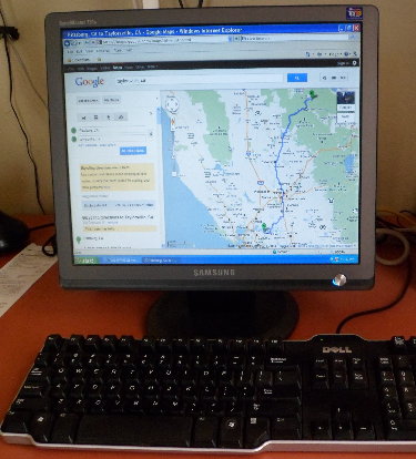
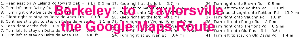
My friend and nextdoor neighbor Bruce had just built a house near Taylorsville/Quincy in the Northern California Sierras. He graciously offered to host us for a night and drive us back to Berkeley. So we had our plan. Coming up with a route, however, was another matter. When touring in Wyoming, Utah or Oregon, for example, it's pretty easy to look at a state map and pick out a quiet, scenic route along numbered highways (avoiding the Interstates naturally). There's often only one way to get from Point A to Point B in these states anyway. But getting us out of Berkeley and the heavy traffic of the San Francisco Bay Area was a challenge. I could see some logical stopping points along the way: Davis, Yuba City, and La Porte; or Davis, Oroville and Bucks Lake. A lack of accommodations in La Porte meant we'd choose the latter route. But getting from one town to the other along lightly traveled and scenic roads was not quite as easy to envision. That's when I noticed that Google Maps has an option to plan a bicycle route (as well as the more usual automobile route). So I gave that a try and here's what we came up with. NEXT |
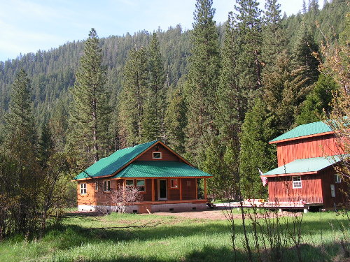 Our Destination in the Northern California Sierras
|